Cavities
Cavities generally occurring in calcareous soils (karst) or due to mining activity may constitute a real danger for all type of activity on the ground surface. The cavity may create ground surface subsidence to sinkhole, generating from fissure in the masonry to the total collapse of building. This phenomenon can also occur in dams. In all cases, the early detection of cavity is the only way to minimize risk for population and structures. Usually employed complementarily to other methods, the electrical resistivity tomography may be sensitive to the presence of cavities.
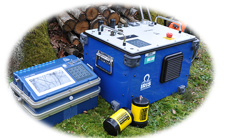
The Syscal Switch range is therefore well adapted to this type of applications (Syscal R1 Switch / Syscal Pro Switch).
The Promis 10 slingram type EM profiler can also be adapted to image long linear or surface (such as for dams).
Landslide
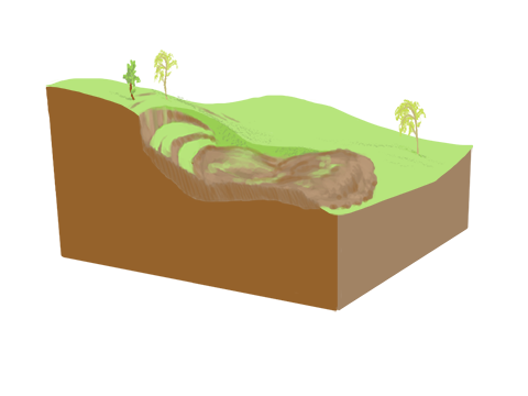
Landslide is one of the major natural hazard in the world. Whether ancient and reactivated or recently triggered, the knowledge of the slip surface depth and geometry allow to estimate the landslide volume to analyze the risk for population and buildings. The Syscal and Syscal Switch range or Fullwaver are well adapted to such applications (Syscal Junior / Syscal Junior Switch / Syscal R1 / Syscal R1 Switch / Syscal R2 / Syscal Pro / Syscal Pro Switch).
In the following example, Travelletti and Malet (2012) have grid the Super-Sauze landslide with Electrical Resistviity Tomography (ERT). They have been able to correlate dynamic penetration tests results with resistivity to dissociate different geotechnical layers and therefore to reconstruct the 3D geometry of the Super-Sauze landslide (depth of C1 and C2 geotechnical layers at each point of the landslide). This allowed to use a realistic geometry of the landslide in hydromechanical models and estimate more accurately the volume of the landslide for risk analysis.
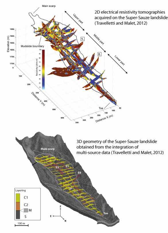
Recently, several research works have shown the possibility of monitoring landslide activity using ERT with the possibility of tracking deformations, infiltrations and soil water content variations with time (Gance et al., 2016, Travelletti et al., 2012, Wilkinson et al., 2010).
The Syscal Pro Switch with the monitoring option is well adapted for such monitoring applications of shallow to slightly deep landslides.
To investigate deeper landslides, we advise the use of the VIP range associated with the Elrec range. Finally, to map landslides over large areas, the Promis 10 slingram type EM profiler can help to highlight conductive anomalies over an area, linked to the presence of landslides.
Geotechnics
Geotechnics can benefit greatly from geophysics. It can be used to identify different contrasted soil layers, to position drillings, to detect depth of foundations or to monitor soil remediation work such as resin infiltration.
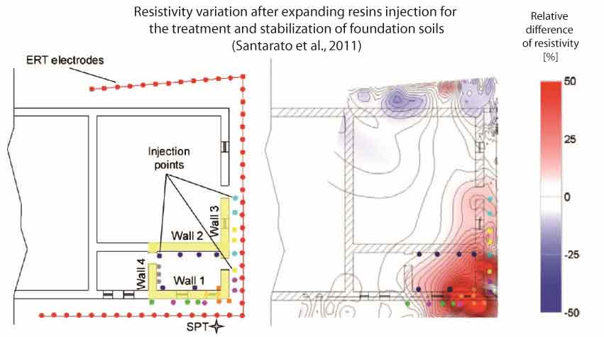
The following example taken from Santarato et al. (2011) shows how electrical resistivity measurements has been use to monitor resins injection for the treatment and stabilization of foundation soils. Soil subsidence due to the local runoff of finer soil fractions can be treated by expanding resins injection. In this example, several injection points are located under the mansory that presents cracks and defects. The percentage difference between the resistivity measured before and after the injections shows a large increase of resistivity (higher than 25 %) where injections have been performed. This technique allows to ensure that the expanding resin penetrate correctly in the soil and that all the area is correctly treated.
In all that cases, the Syscal and Syscal Switch ranges are well adapted to sound or image the soil electrical resistivity (Syscal Junior / Syscal Junior Switch / Syscal R1 / Syscal R1 Switch / Syscal R2 / Syscal Pro / Syscal Pro Switch).
The Promis 10 slingram type EM profiler can also be used to assess the lateral extension and depth of clayey layers for large areas.
References
Gance, J., Malet, J. P., Supper, R., Sailhac, P., Ottowitz, D., & Jochum, B. (2016). Permanent electrical resistivity measurements for monitoring water circulation in clayey landslides. Journal of Applied Geophysics, 126, 98-115.
Travelletti, J., Sailhac, P., Malet, J. P., Grandjean, G., & Ponton, J. (2012). Hydrological response of weathered clay‐shale slopes: water infiltration monitoring with time‐lapse electrical resistivity tomography. Hydrological processes, 26(14), 2106-2119.
Travelletti, J., & Malet, J. P. (2012). Characterization of the 3D geometry of flow-like landslides: a methodology based on the integration of heterogeneous multi-source data. Engineering Geology, 128, 30-48.
Santarato, G., Ranieri, G., Occhi, M., Morelli, G., Fischanger, F., & Gualerzi, D. (2011). Three-dimensional Electrical Resistivity Tomography to control the injection of expanding resins for the treatment and stabilization of foundation soils. Engineering Geology, 119(1), 18-30.
Wilkinson, P. B., Chambers, J. E., Meldrum, P. I., Gunn, D. A., Ogilvy, R. D., & Kuras, O. (2010). Predicting the movements of permanently installed electrodes on an active landslide using time-lapse geoelectrical resistivity data only. Geophysical Journal International, 183(2), 543-556.